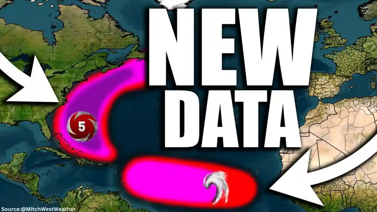
Hurricane Erin has emerged as the inaugural hurricane of the 2025 Atlantic season, drawing attention from meteorologists and residents along potential impact zones. As of mid-August 2025, this storm has demonstrated rapid intensification, briefly reaching Category 5 status before settling into a powerful Category 4 system.
Forecasts indicate that Hurricane Erin will largely bypass direct land contact, navigating north of key Caribbean regions and remaining offshore from the U.S. East Coast. This trajectory minimizes some risks but still poses threats through indirect effects like elevated surf and precipitation.
Hurricane Erin Forms and Intensifies
Current Strength of Hurricane Erin
Hurricane initially formed as a tropical storm before escalating to hurricane status on August 14, 2025. It achieved peak winds of 160 mph during its Category 5 phase, marking a historic early-season event.
However, an eyewall replacement cycle led to a downgrade to Category 4, with sustained winds around 145-150 mph as of August 16. Experts anticipate ongoing intensity variations due to environmental factors such as wind shear, but the storm is projected to sustain major hurricane force.
Fluctuations in Hurricane Erin’s Intensity
Models suggest possible weakening over the coming days, influenced by cooler waters and atmospheric disruptions. Despite this, Hurricane remains a formidable system, capable of regenerating strength if conditions improve.
This nuance highlights the unpredictable nature of tropical cyclones, emphasizing the need for continuous monitoring.
Projected Path of Hurricane Erin
Hurricane Erin’s Movement Through the Atlantic
Hurricane is currently advancing west-northwest at approximately 10-15 mph. It is expected to skirt north of the northern Leeward Islands, U.S. and British Virgin Islands, and Puerto Rico between August 17 and 19.
Following this, the storm should veer northward, passing east of the Bahamas and well offshore from Florida and the U.S. mainland. By mid-week, it may position between Bermuda and North Carolina’s Outer Banks, eventually curving into the open North Atlantic.
You May Also Like:
IRS Stimulus Check: Shocking Truth About 2025 Payments
Nvidia and AMD to Share 15% of China Chip Sales with U.S. Government
Spaghetti Models for Hurricane Erin
Ensemble forecasts, often visualized as spaghetti models, show a consensus on an offshore track with some variability. While a few outliers suggest closer approaches to land, the predominant outlook avoids U.S. landfall, reducing the likelihood of catastrophic direct hits. This path evolution reflects high-pressure systems steering the storm away from populated areas.
Potential Impacts from Hurricane Erin
Rainfall and Flooding Risks with Hurricane Erin
Even without landfall, Hurricane could deliver 2-8 inches of rain to the northern Leeward Islands, Virgin Islands, and Puerto Rico, heightening risks of flash flooding and mudslides in vulnerable terrains. Isolated higher amounts may occur in mountainous regions, exacerbating erosion concerns.
Surf and Rip Current Hazards from Hurricane Erin
Dangerous swells generated by Hurricane are forecasted to affect the U.S. East Coast, including Florida, from August 18 onward, extending to the Bahamas, Bermuda, and Atlantic Canada through August 27.
These conditions could produce life-threatening rip currents and high surf, posing dangers to beachgoers and maritime activities.
Broader Regional Effects of Hurricane Erin
Indirect impacts may include gusty winds and scattered showers for areas like the Greater Antilles. Bermuda could experience tropical storm-force winds if the path shifts slightly westward, though current predictions keep the core offshore.
No widespread evacuations are mandated, but preparedness is advised for coastal communities.
Hurricane Erin’s development underscores the active 2025 season predictions, with warmer ocean temperatures fueling such systems. Residents in at-risk zones should secure emergency kits, review evacuation plans, and stay informed via official channels like the National Hurricane Center.
Additional Perspectives on Hurricane Erin
From various angles, Hurricane Erin serves as a reminder of climate influences on storm patterns, with experts noting increased frequency of rapid intensification events. Community responses include heightened awareness in the Caribbean, where past hurricanes have built resilience. Future outlooks suggest dissipation over cooler northern waters by late August, but long-range models remain tentative.
This storm also highlights advancements in forecasting technology, allowing earlier warnings and better resource allocation.
Disclaimer: This article synthesizes information from unverified reporting as of August 17, 2025. Forecasts can change rapidly; always consult official sources like the National Hurricane Center for the latest updates.
Sources:
- Weather.com
- Article: “Hurricane Erin Maps Tracker: Spaghetti Models, Path & More”
- Link: https://weather.com/storms/hurricane/news/2025-08-17-hurricane-erin-maps-tracker-radar-path-spaghetti-models
- ABC News
- Article: “Hurricane Erin tracker: Latest path, maps for 1st hurricane of Atlantic season”
- Link: https://abcnews.go.com/US/hurricane-erin-tracker-latest-path-maps-1st-hurricane/story?id=112944689
- FOX 35 Orlando
- Article: “Hurricane Erin forms, becoming first hurricane of the 2025 Atlantic season; Will it impact Florida?”
- Link: https://www.fox35orlando.com/news/hurricane-erin-forms-becoming-first-hurricane-2025-atlantic-season-will-it-impact-florida